Cartography, the art and science of mapmaking, has a long and fascinating history. From ancient civilizations to the modern era, maps have been instrumental in shaping our understanding of the world. Here, we explore the evolution of cartography through some of the most famous world maps and intriguing anecdotes.
Ancient and Medieval Maps
- Babylonian World Map (6th century BCE)
One of the earliest known world maps, it depicts Babylon at the center of the world. This map includes mythical places and is more symbolic than accurate, reflecting the Babylonians' worldview.
- Ptolemy’s Geographia (2nd century CE)
Claudius Ptolemy’s work was a comprehensive treatise on geography and mapmaking. Rediscovered during the Renaissance, Ptolemy’s coordinates for places influenced European exploration.
- Mappa Mundi (Hereford, 1300)
A medieval European map, it combines geography with theology. Jerusalem is placed at the center, illustrating the map’s religious significance rather than geographical accuracy.
Age of Exploration
- Cantino Planisphere (1502):
A Portuguese map showing the discoveries of the New World. Smuggled out of
Portugal to Italy, it highlights the competitive nature of exploration and cartography.
The first map to use the name "America" for the New World. Only one known copy exists, discovered in 1901 and now housed in the Library of Congress.
Renaissance and Enlightenment
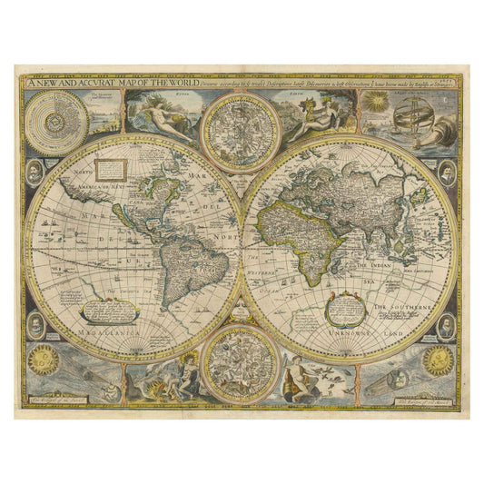
- Mercator’s World Map (1569)
Gerardus Mercator’s map introduced the Mercator projection, which became a standard for nautical navigation. While it distorts size, especially near the poles, it accurately represents angles, aiding sailors.
- Blaeu’s Atlas Maior (1662) :
An extensive and beautifully illustrated atlas by Joan Blaeu. Commissioned by wealthy patrons, it reflects the golden age of Dutch cartography.
Modern Era
- John Snow’s Cholera Map (1854) :
A map of cholera cases in London, used to identify the source of an outbreak. This map is an early example of using maps for public health and epidemiology.
- Peters Projection Map (1974)
Arno Peters’ map aims to represent countries' sizes more accurately relative to each other. It sparked controversy and debate over the best way to represent our world highlighting the influence of maps on perceptions.
Types of Illustrations in Ancient Geographic Maps
Ancient geographic maps are distinguished by a variety of styles and types of illustrations, each reflecting the knowledge and beliefs of its time. Here is an overview of the different types of illustrations found in ancient geographic maps:
1. Portolan Charts
Description: Marine maps used by medieval navigators, primarily between the 13th and 16th centuries.
Characteristics: They show rhumb lines (wind directions) radiating from central points and cover the map in a complex web. Coastlines are drawn accurately, and important ports are marked.
Examples: The Cantino Planisphere (1502) and the Piri Reis map (1513).
2. Mappae Mundi
Description: Medieval maps representing the known world to Europeans in the Middle Ages.
Characteristics: They combine geography and theology, often with Jerusalem at the center. These maps include biblical places, mythological creatures, and world wonders.
Examples: The Hereford Mappa Mundi (circa 1300) and the Ebstorf map (13th century).
3. Ptolemaic Maps
Description: Based on the works of Greek astronomer Ptolemy, these maps influenced cartography for centuries after their rediscovery during the Renaissance.
Characteristics: They use a system of latitude and longitude and depict a world centered on the Mediterranean, often with incorrect proportions of the continents.
Examples: Reprints of Ptolemy’s "Geographia," notably by cartographers like Martin Waldseemüller in the early 16th century.
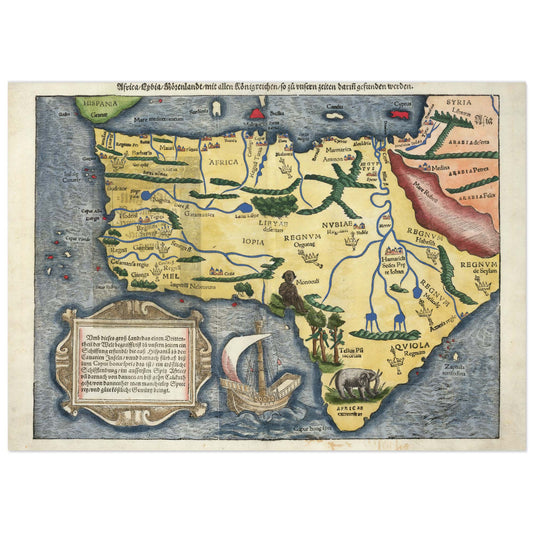
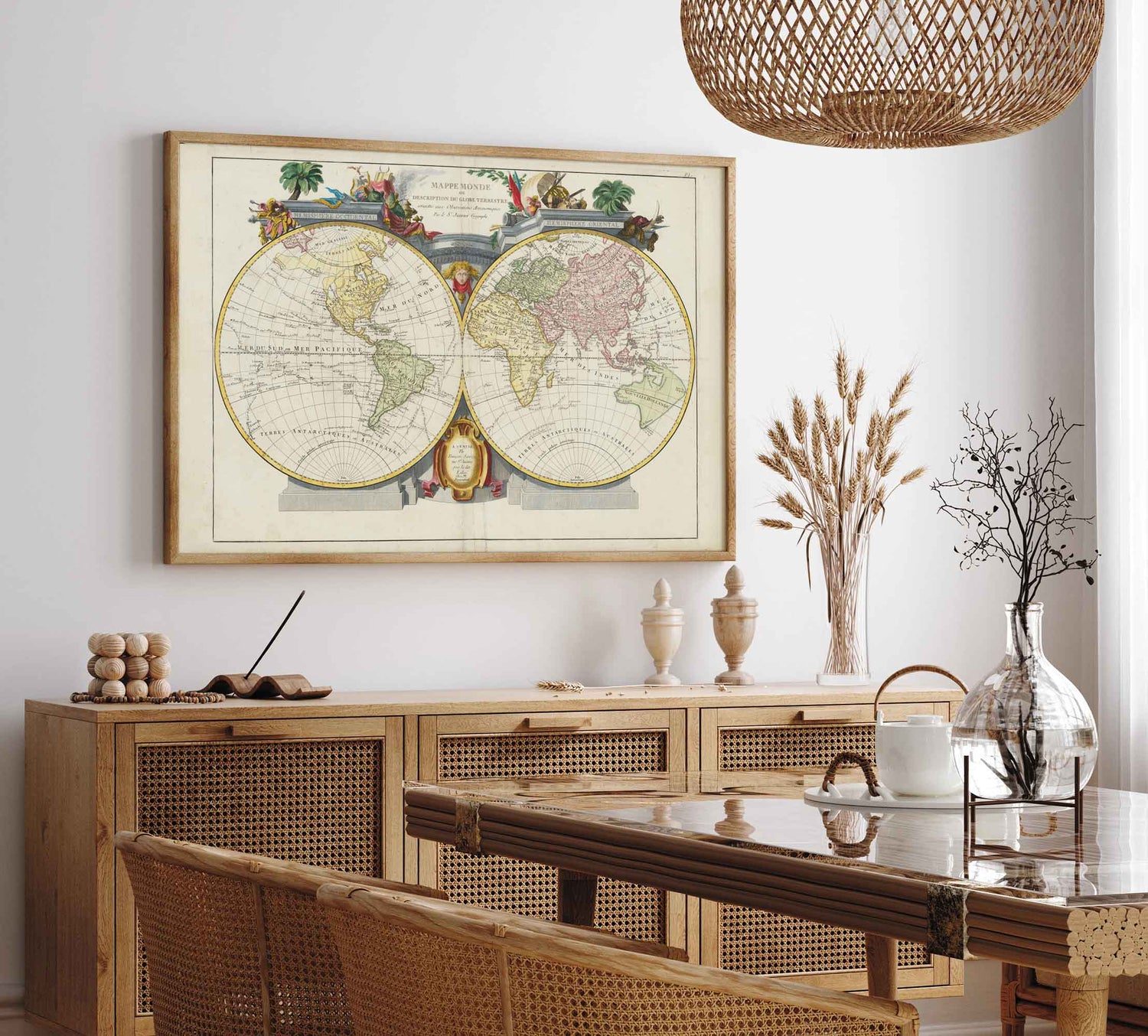
4. Renaissance Maps
Description: Maps produced during the Renaissance, marked by increased accuracy and European explorations.
Characteristics: They combine art and science, with more precise geographic details and often decorative illustrations such as mythological creatures, ships, and compass roses.
Examples: Maps by Gerardus Mercator, especially his 1569 world map, and Abraham Ortelius’ atlases like "Theatrum Orbis Terrarum" (1570).
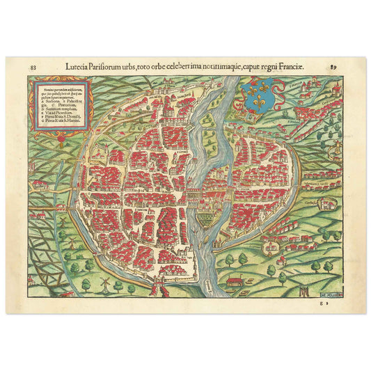
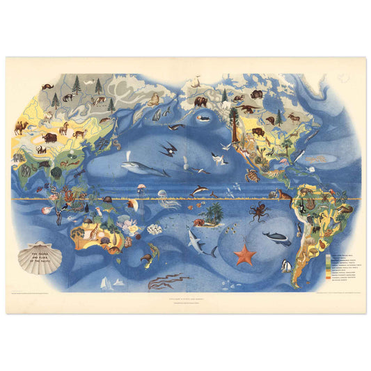
5. Wall Maps
Description: Large maps intended to be hung on walls, often in classrooms, libraries, or palaces.
Characteristics: They are often richly decorated with ornate borders, illustrations of historical figures, flora and fauna, and mythological scenes.
Examples: Wall maps by Blaeu in the "Atlas Maior" (1662).
6. Celtic and Viking Maps
Description: Maps created by the Celts and Vikings for navigation and depiction of explored territories.
Characteristics: Simple and often symbolic, these maps use natural landmarks like mountains, rivers, and coastlines.
Examples: The Vinland map of the Vikings (dating from the medieval period) is a controversial map purportedly showing Norse explorations in North America.
7. Chinese and Arabic Maps
Description: Maps produced in Chinese and Islamic traditions, reflecting the advanced geographic knowledge of these cultures.
Characteristics: Chinese maps, like those of the Ming dynasty, show a world centered on China with accurate proportions of surrounding regions. Islamic maps, influenced by geographers like Al-Idrisi, combine geographic precision with artistic illustrations.
Examples: The Kangnido map (1402) and Al-Idrisi’s "Tabula Rogeriana" (1154).
8. Propaganda Maps
Description: Maps created for political or propaganda purposes, often to showcase a country's power or influence.
Characteristics: They exaggerate or minimize certain regions for political reasons, using symbolic illustrations to convey subliminal messages.
Examples: Colonial-era maps showing European empires and their colonies in vivid colors.
Interesting Anecdotes
The Vinland Map: The discovery of the Vinland map sparked controversy over the authenticity of this medieval map, purportedly showing Norse explorations in North America before Columbus.
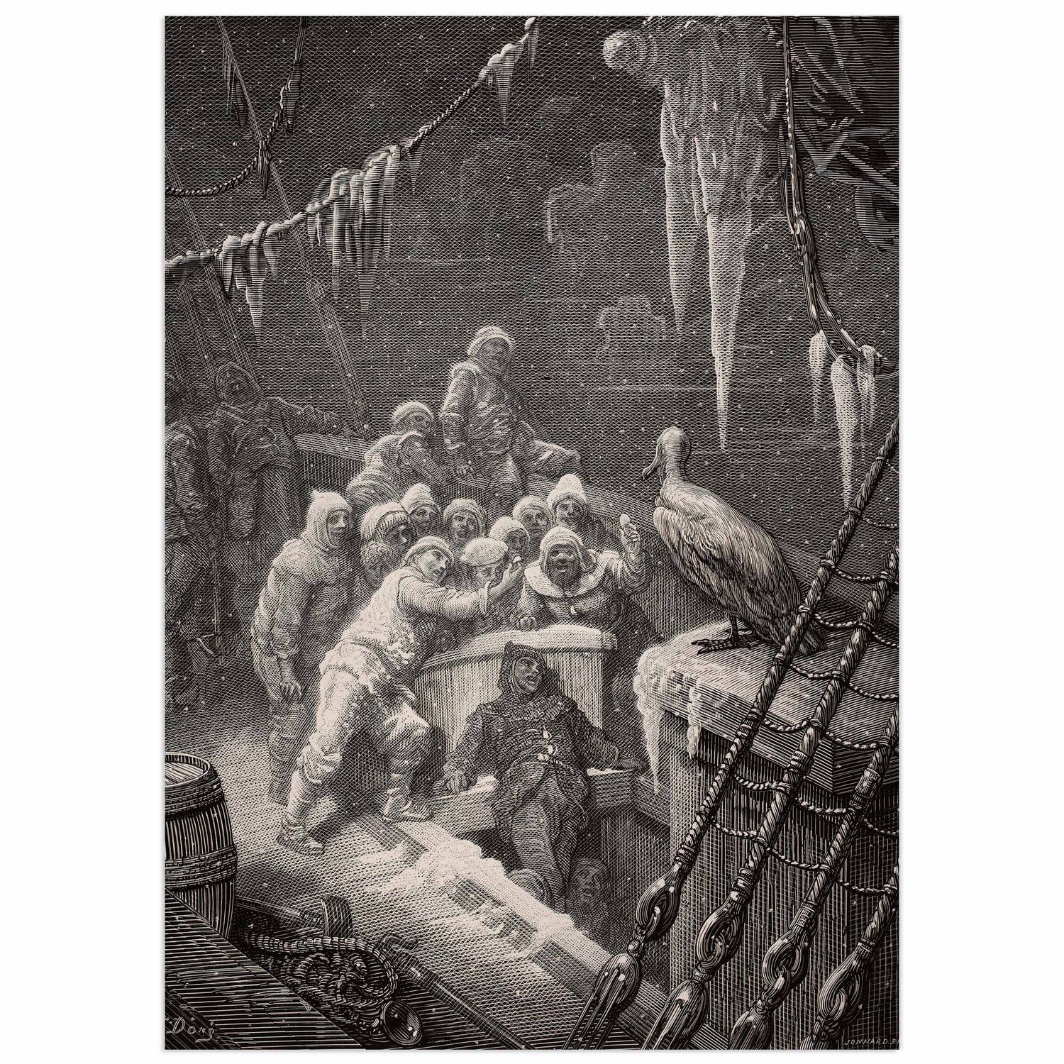
Dragons and Monsters: Medieval and Renaissance maps were often decorated with illustrations of mythological creatures, reflecting beliefs and limited knowledge of unexplored regions.
Oronce Finé’s Map: In 1531, Oronce Finé created a heart-shaped map of the world, a unique aesthetic representation that innovatively combined science and art.
In summary, ancient geographic maps are not only navigation tools but also works of art and historical documents that offer insight into the perceptions and knowledge of past civilizations.
What types of maps are available?
There are a wide range of maps on the market, including vintage maps, period prints and reproductions.
Where to buy old maps ?
Maps and period reproductions can be purchased from specialized online stores, auctions or flea markets. Some bookshops also sell vintage atlases in beautiful original editions containing maps.
At Wallango.com, we sell modern reproductions at excellent value for money. We specialize in high-definition printing and our posters are printed on top-of-the-range paper (250 gr/m2). We ensure that every detail is reproduced and that colors are as faithful as possible to the original images. Our digital restoration teams work to this end, guaranteeing you high-quality images.
Our top-selling old map posters :
Sea Monster Map of Iceland
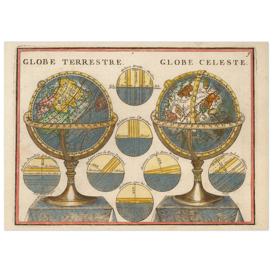
The Celestial hémisphères by Jacques Chiquet.
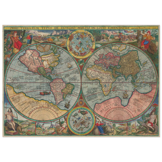
Planiglobii Decorative double hemisphere world map
Double hemisphere by Santini
How to decorate your home with reproductions of old maps?
An antique map, whether an original or a modern reproduction, is a fantastic decorative object to embellish your walls. Acquiring a faithful reproduction of an antique map will breathe a special atmosphere into your home: it's a wonderful stimulus to the imagination, taking you on a journey through time and space to an adventurous and sometimes dangerous world.