
Wallango
A Plan of the City's Of London, Westminser and Borough
A Plan of the City's Of London, Westminser and Borough
Couldn't load pickup availability
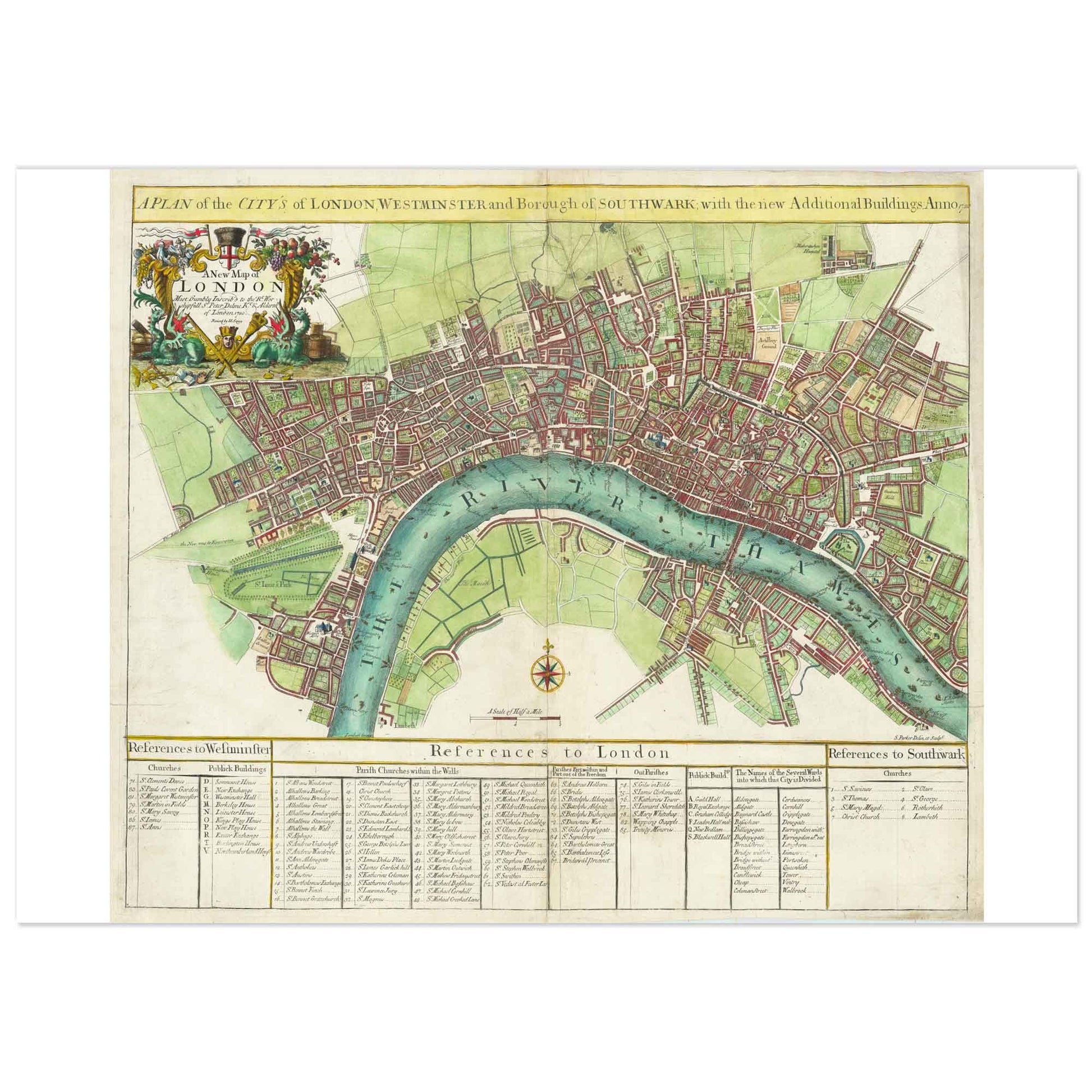
Discover a high definition print of an 18th-century antique map depicting London, Westminster, and Southwark. This detailed historical illustration showcases the winding River Thames, densely packed city streets, and surrounding green spaces. A decorative title cartouche graces the top left corner, while a comprehensive reference table below lists notable landmarks and buildings.
Perfect for collectors of historical maps, lovers of London’s urban history, or anyone seeking unique wall art, this print offers a fascinating bird’s-eye view of London’s development during the 18th century.
About the print:
✓ Thick, matte, museum-quality paper (230 g) for a luxurious, durable finish
✓ Printing from ultra-high-definition images, preserving every detail and nuance
✓ Ideal for framing in a study, office, or living room
Shipping & Returns
Shipping & Returns
SHIPPING: Items are made to order and typically ship within 6-8 business days. More information about delivery options.
RETURNS: Return requests can be made within 30 days of your item(s) delivery. Please use the contact form so that we can send you the return procedure.
Specifications
Specifications
SIZES : Our posters are printed in inches or in centimeters. These systems are to be preferred according to the country in which you live in order to find more easily the corresponding frames. Click here for more information about size options.
SPECIFICATIONS : Premium mat art paper, Weather-resistant. The paper mill, the pulp used to make the paper and the paper itself are all certified by the Forest Stewardship Council®.
- Worldwide delivery
- Easy return
- Free shipping on two or more items
